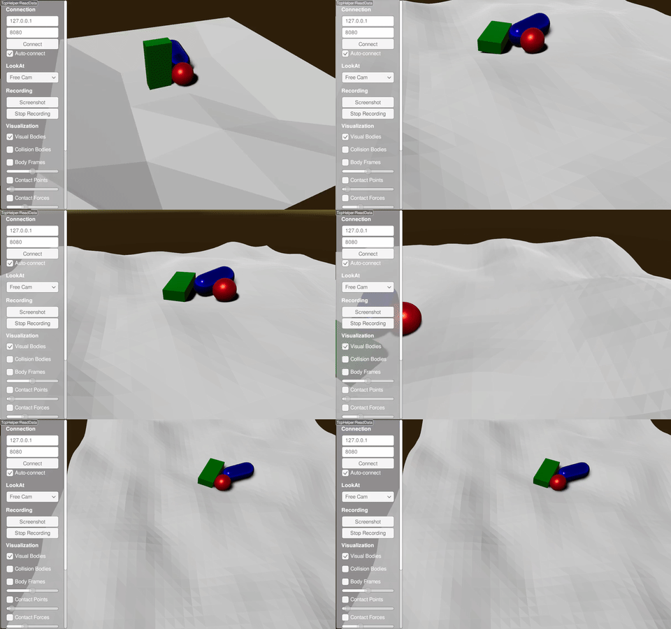
Height Map Using the Terrain Generator

XML Way
Try it yourself with
./xmlReader <PATH_TO_RAISIMLIB>/rsc/xmlScripts/heightMaps/heightMapUsingTerrainGenerator.xml
The xml file is constructed as following:
<?xml version="1.0" ?>
<raisim version="1.0">
    <timeStep value="0.001"/>
    <objects>
        <sphere name="sphere" mass="1">
            <dim radius="0.5" />
            <inertia xx="0.1" xy="0" xz="0" yy="0.1" yz="0" zz="0.1" />
            <state pos="0 0 5" quat="1 0 0 0" linVel="0 0 0" angVel="0 0 0" />
        </sphere>
        <capsule name="capsule" mass="1">
            <dim radius="0.5" height="1" />
            <inertia xx="0.1" xy="0" xz="0" yy="0.1" yz="0" zz="0.1" />
            <state pos="1 0 5" quat="1 0 0 0" linVel="0 0 0" angVel="0 0 0" />
        </capsule>
        <box name="box" mass="1">
            <dim x="0.5" y="1" z="2"/>
            <inertia xx="0.1" xy="0" xz="0" yy="0.1" yz="0" zz="0.1" />
            <state pos="1 1 5" quat="1 0 0 0" linVel="0 0 0" angVel="0 0 0" />
        </box>
        <heightmap name="terrain" xSample="50" ySample="50" xSize="20" ySize="20" centerX="0" centerY="0">
            <terrainProperties frequency="0.2" zScale="3.0" fractalOctaves="3" fractalLacunarity="2.0" fractalGain="0.25" stepSize="0" heightOffset="0" seed="0"/>
        </heightmap>
    </objects>
</raisim>
The perlin parameters are not very trivial to understand. Play with them to get the shape you want.
C++ Way
raisim::TerrainProperties terrainProperties;
terrainProperties.frequency = 0.2;
terrainProperties.zScale = 3.0;
terrainProperties.xSize = 20.0;
terrainProperties.ySize = 20.0;
terrainProperties.xSamples = 50;
terrainProperties.ySamples = 50;
terrainProperties.fractalOctaves = 3;
terrainProperties.fractalLacunarity = 2.0;
terrainProperties.fractalGain = 0.25;

auto hm = world.addHeightMap(0.0, 0.0, terrainProperties);